Remote sensing technologies have revolutionized the way we observe and understand the Earth’s environment. From the depths of the oceans to the upper echelons of the atmosphere, these technologies offer a bird’s eye view of our planet, capturing data that were once unimaginable. This guide dives deep into the world of remote sensing, exploring its applications in environmental monitoring and change detection. You’re about to embark on a journey through the skies and beyond, unraveling the complexities of our planet through the lens of cutting-edge technology.
What You Will Learn
By reading this article, you will learn about remote sensing technologies for environmental monitoring and change detection, including different platforms, data processing, analysis, and applications. – Various platforms and sensors used in remote sensing. – The process of remote sensing data processing and analysis. – Applications of remote sensing in environmental monitoring and change detection.
1. Introduction
Forget the traditional notions of environmental monitoring. The era of remote sensing technologies has ushered in a new paradigm, enabling scientists, researchers, and environmentalists to track changes in our environment with unprecedented precision and scale. This isn’t just about snapping pictures from space; it’s about decoding the stories our planet tells us, pixel by pixel. Whether you’re a technophile with a green heart or an environmentalist fascinated by tech solutions, you’re in the right place.
2. Remote Sensing Platforms and Sensors
2.1. Satellite Remote Sensing
Satellites, the juggernauts of remote sensing, orbit our planet, capturing detailed images and data across various spectral bands. From the iconic Landsat series, which has been monitoring Earth since the 1970s, to the advanced Sentinel satellites of the European Space Agency, these celestial observers offer a comprehensive view of global environmental changes. The beauty of satellite remote sensing lies in its ability to cover vast areas, making it invaluable for tracking phenomena like deforestation, urban sprawl, and glacier retreat on a global scale.
Insider Tip: Keep an eye on the launch schedules of new satellites. Each brings enhanced capabilities, offering richer data for environmental monitoring.
2.2. Airborne Remote Sensing
Before satellites took the stage, airplanes were the workhorses of remote sensing. Equipped with cameras, LiDAR (Light Detection and Ranging), and hyperspectral sensors, these flying laboratories provide high-resolution data over specific areas. While their coverage is more limited than satellites, the level of detail they capture is unparalleled, making them perfect for projects requiring fine-scale analysis, such as mapping biodiversity in a tropical rainforest or assessing damage after a natural disaster.
2.3. Unmanned Aerial Vehicles (UAVs)
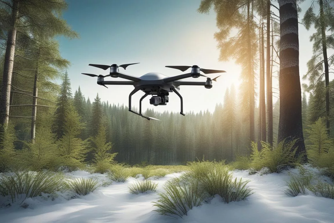
UAVs, or drones, have brought remote sensing capabilities to the masses. Affordable, versatile, and easy to deploy, drones are revolutionizing environmental monitoring at the local level. Whether it’s a farmer assessing crop health, a scientist mapping a melting glacier, or a conservationist keeping tabs on wildlife, drones offer a new perspective on environmental change. Their ability to fly lower and slower than airplanes means they can capture ultra-high-resolution images, providing insights that were once out of reach.
2.4. Ground-Based Remote Sensing
Ground-based sensors complete the remote sensing toolkit, offering a close-up view of environmental changes. From weather stations recording climate data to seismic sensors monitoring volcanic activity, these instruments provide critical ground-truth data that complement aerial and satellite observations. In a way, they are the unsung heroes of remote sensing, ensuring that the data we collect from the skies are accurate and reliable.
3. Remote Sensing Data Processing and Analysis
3.1. Preprocessing
Before any analysis can begin, remote sensing data must undergo preprocessing. This includes correcting for atmospheric interference, aligning images accurately, and calibrating sensor readings. It’s a meticulous process, but essential for ensuring the data we analyze reflect the true conditions on the ground.
Insider Tip: Mastering preprocessing techniques is crucial for anyone looking to work with remote sensing data. It’s the foundation upon which all further analysis is built.
3.2. Image Classification
Once the data are preprocessed, image classification comes into play. This involves categorizing pixels in an image into classes based on their spectral signatures. For example, differentiating between water, vegetation, urban areas, and bare soil. Advanced machine learning algorithms have greatly enhanced the accuracy of image classification, enabling more sophisticated environmental monitoring and analysis.
3.3. Change Detection
Change detection is the heart of environmental monitoring with remote sensing. By comparing images over time, scientists can identify changes in land use, vegetation cover, water bodies, and more. This not only helps in tracking natural phenomena but also in assessing the impact of human activities on the environment. The insights gained from change detection are invaluable for informing conservation efforts, urban planning, and climate change mitigation strategies.
4. Applications of Remote Sensing in Environmental Monitoring and Change Detection
4.1. Land Use and Land Cover Change Detection
Tracking changes in land use and cover is crucial for understanding the dynamics of our environment. Remote sensing technologies enable us to monitor deforestation, urban expansion, agricultural development, and natural habitat loss on a global scale. These insights are vital for sustainable land management and conservation planning.
4.2. Forest Monitoring and Change Detection
Forests are the lungs of our planet, and remote sensing is key to their preservation. It allows for the monitoring of forest health, the detection of illegal logging activities, and the assessment of reforestation efforts. By keeping a watchful eye on our forests, we can combat climate change and protect biodiversity.
For more on this, check out our guide on forest monitoring technologies.
4.3. Wetland Monitoring and Change Detection
Wetlands are among the most productive ecosystems on Earth, yet they are also among the most threatened. Remote sensing technologies offer a way to monitor these vital areas, tracking changes in their extent and health. This information is crucial for the conservation of wetlands and the myriad species they support.
4.4. Water Quality Monitoring and Change Detection
The quality of our water resources is under constant threat from pollution, eutrophication, and climate change. Satellite and drone imagery can help monitor water quality, detecting changes in turbidity, chlorophyll levels, and harmful algal blooms. This information is essential for managing water resources and protecting aquatic ecosystems.
Learn more about water quality monitoring at /water-quality-monitoring-technologies/.
4.5. Soil Erosion Monitoring and Change Detection
Soil is the foundation of our food system, yet it’s being eroded at alarming rates. Remote sensing technologies can help track soil erosion, identifying vulnerable areas and assessing the effectiveness of conservation measures. This information is critical for sustainable agriculture and land management practices.
4.6. Air Quality Monitoring and Change Detection
Air quality is a major concern for public health and the environment. While ground-based sensors are the primary means of monitoring air quality, satellite data can provide a broader picture, identifying pollution hotspots and tracking the movement of air pollutants on a global scale.
For detailed insights, explore our guide on air quality monitoring technologies.
5. Conclusions
Remote sensing technologies have opened a new window onto our planet, offering unparalleled insights into environmental changes and challenges. From satellites to drones, these tools empower us to monitor our world more closely and accurately than ever before. As we face the growing threats of climate change, habitat loss, and pollution, remote sensing stands as a beacon of hope, guiding our efforts to protect and preserve the Earth for future generations.
The journey through the realms of remote sensing technologies for environmental monitoring and change detection is a testament to human ingenuity and our commitment to the planet. As we continue to innovate and refine these technologies, the possibilities for understanding and safeguarding our environment are limitless. Let’s embrace this remarkable toolkit, for in it lies the key to a sustainable future.
FAQs
Who uses remote sensing technologies for environmental monitoring?
Scientists, environmental agencies, and researchers use these technologies.
What is remote sensing technology for environmental monitoring?
It involves using sensors to gather data from a distance to monitor the environment.
How does remote sensing technology help in environmental monitoring?
It provides valuable data on changes in land use, vegetation, and pollution levels.
Isn’t remote sensing technology for environmental monitoring expensive?
While initial costs can be high, the long-term benefits outweigh the expenses.
Who benefits from remote sensing technologies in climate change efforts?
Governments, policymakers, and conservation organizations benefit from the insights provided.
How can remote sensing technologies enhance climate change solutions?
By providing accurate and timely data to support climate change mitigation and adaptation efforts.
Next Steps
Round Table Environmental Informatics (RTEI) is a consulting firm that helps our clients to leverage digital technologies for environmental analytics. We offer free consultations to discuss how we at RTEI can help you.