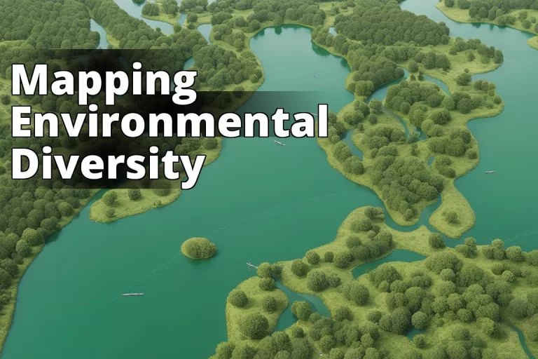
In the battle against climate change and environmental degradation, Geographic Information Systems (GIS) have emerged as unsung heroes. These powerful tools are revolutionizing the way we understand, monitor, and manage our environment. Far from being just another tech fad, GIS is a game-changer, offering insights and solutions to some of the most pressing environmental issues of our time.
Learn about Geographic Information Systems for Environmental Monitoring
By reading this article, you will learn:
– What GIS is and how it works for environmental monitoring and management
– The benefits and challenges of using GIS in environmental monitoring
– Examples of GIS application in environmental monitoring and the future trends
How GIS is Helping to Monitor and Manage the Environment
GIS technology has become a cornerstone in environmental monitoring and management, providing a detailed and dynamic picture of our changing planet. It’s like having a high-resolution map of the entire globe, but one that can show you everything from temperature patterns to the distribution of endangered species. The beauty of GIS lies not just in the mapping, but in its ability to integrate and analyze various types of data, turning them into actionable insights.
Let me share a personal anecdote to illustrate this. A few years ago, I was part of a team working on a project to monitor deforestation in the Amazon. Using GIS, we were able to map the extent of deforestation over time, identify hotspots, and understand the underlying causes. This information was crucial in devising targeted conservation strategies and engaging local communities in sustainable land-use practices.
What is GIS?
At its core, Geographic Information Systems for Environmental Monitoring is a digital tool that captures, stores, analyzes, and displays geographical data. Imagine combining traditional maps with the dynamic capabilities of modern computing that’s GIS in a nutshell. It allows users to visualize, question, analyze, and interpret data to understand relationships, patterns, and trends in the environment.
How does GIS work?
GIS operates through a complex interplay of software and hardware components. It uses spatial and statistical methods to analyze attributes and characteristics of the Earth’s surface and atmosphere. The process starts with data collection, which might come from satellite imagery, GPS data, or on-the-ground sensors. This data is then layered and spatially analyzed to reveal patterns or trends that are not immediately obvious, providing a multifaceted view of environmental phenomena.
How is GIS used in Environmental Monitoring and Management?
Mapping
GIS excels at mapping, allowing for the precise visualization of environmental data. It can display anything from the spread of wildfires to the retreat of glaciers with startling clarity. This capability not just aids in understanding the scale of an issue but also in communicating it effectively to both policymakers and the public.
Data Collection
GIS technologies facilitate the gathering of environmental data in real-time, which is essential for monitoring dynamic ecosystems. Whether it’s tracking the migration patterns of birds or measuring air quality levels across a city, GIS makes data collection more efficient and accurate.
Data Analysis
The true power of GIS lies in its ability to analyze vast amounts of environmental data. By applying spatial analysis techniques, GIS can uncover hidden patterns, correlations, and trends, providing a deeper understanding of environmental processes.
Data Sharing
GIS promotes the sharing of environmental data among researchers, conservationists, and policymakers. By creating a common platform for data exchange, it fosters collaboration and ensures that decisions are based on the most current and comprehensive information available.
What are the Benefits of Using GIS in Environmental Monitoring and Management?
GIS offers a multitude of benefits, from enhancing our understanding of environmental dynamics to improving decision-making processes. It enables targeted interventions, facilitates efficient resource management, and promotes sustainable development practices. Moreover, by making environmental data accessible and understandable, GIS empowers communities to participate more actively in conservation efforts.
What are the Challenges of Using GIS in Environmental Monitoring and Management?
Despite its advantages, GIS faces several challenges. Data accuracy and availability can be a major issue, as environmental monitoring often relies on inputs from various sources, which may not always be consistent or reliable. Additionally, the complexity of GIS software requires specialized skills, and there’s an ongoing need for training and capacity building among users.
What are Some Examples of GIS Being Used in Environmental Monitoring and Management?
Monitoring Deforestation
GIS technology is invaluable in tracking changes in forest cover, helping to combat deforestation. By analyzing satellite imagery over time, GIS can pinpoint areas of concern, enabling targeted conservation efforts.
Managing Water Resources
Water resource management is another area where GIS is making a significant impact. It can track changes in water quality and quantity, aiding in the sustainable management of these critical resources. Learn more about water quality monitoring technologies.
Tracking Wildlife
GIS is also a vital tool for wildlife conservation, allowing researchers to track animal movements and understand habitat use. This information is crucial for creating effective conservation strategies and protecting endangered species.
Monitoring Air Quality
In urban and industrial areas, GIS helps monitor air quality, providing data that can inform policies and interventions to reduce pollution and protect public health. Explore air quality monitoring technologies.
Managing Waste
GIS can assist in waste management by optimizing collection routes, identifying suitable locations for recycling centers, and monitoring landfill sites. This contributes to more sustainable and efficient waste management practices.
What are the Future Trends for GIS in Environmental Monitoring and Management?
The future of GIS in environmental monitoring and management is bright, with several exciting trends on the horizon. The integration of GIS with Internet of Things (IoT) devices and big data analytics will provide even more precise and timely insights into environmental conditions. Moreover, advancements in AI and machine learning will enhance the predictive capabilities of GIS, enabling more proactive and preventative approaches to environmental management. The rise of citizen science and the increasing availability of open-source GIS tools are also democratizing access to environmental data, fostering a more inclusive approach to environmental stewardship.
In conclusion, Geographic Information Systems are not just a technological innovation; they are a crucial ally in our efforts to monitor and manage the environment sustainably. By harnessing the power of GIS, we can make more informed decisions, implement more effective interventions, and move closer to achieving a balance between human needs and the health of our planet. It’s a complex journey, but with GIS lighting the way, we have a clearer path towards a sustainable future.
Questions and Answers
What are Geographic Information Systems for environmental monitoring?
Geographic Information Systems (GIS) are tools that analyze and visualize environmental data.
Who can benefit from using GIS for environmental monitoring?
Environmental scientists, government agencies, and conservation organizations can benefit from GIS.
How are GIS used in climate change monitoring?
GIS are used to map and analyze changes in temperature, precipitation, sea level, and land use patterns.
What makes GIS an effective tool for environmental monitoring?
GIS allows for spatial analysis and visualization of complex environmental data, making it easier to identify patterns and trends.
How can GIS help in addressing climate change challenges?
GIS can help in identifying vulnerable areas, planning for adaptation strategies, and monitoring the effectiveness of climate change interventions.
Isn’t GIS technology expensive and difficult to learn?
While GIS technology can require an initial investment, there are user-friendly and affordable options available, and many resources for learning GIS are accessible online.