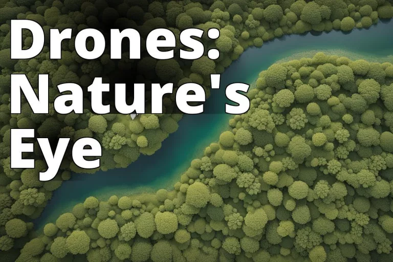
For environmental professionals tasked with evaluating the potential impacts of proposed development projects, conducting comprehensive assessments is of paramount importance. While traditional methods have served this purpose, these traditional methods can often be time-consuming, labor-intensive, and limited in scope. Drones, or unmanned aerial vehicles (UAVs), offer a cost-effective aerial perspective that significantly enhances most stages of an environmental assessment project. This article describes the phases on an Environmental Assessment and how drones can be used in each phase.
Project Screening and Scoping Phase
Drones can play a valuable role in the Project Screening and Scoping phase of an Environmental Assessment in several ways:
- Site Reconnaissance: Drones equipped with high-resolution cameras can provide aerial imagery and videos of the proposed project site and surrounding areas. This aerial reconnaissance helps identify potential environmental concerns, sensitive habitats, cultural resources, or areas that may require further investigation during the assessment process.
- Preliminary Mapping: Aerial imagery captured by drones can be used to create detailed maps of the project site and its surroundings. These maps can help delineate boundaries, identify land cover types, and provide an initial understanding of the site’s topography and landscape features, aiding in defining the scope of the assessment.
- Identifying Stakeholder Concerns: Drone footage can be shared with stakeholders, such as local communities, environmental groups, or regulatory authorities, during the scoping process. This visual representation of the site can facilitate discussions and help identify potential concerns or areas of interest that should be addressed in the assessment.
- Accessibility Assessment: Drones can survey the project site and surrounding areas to assess accessibility for field crews and equipment. This information can help plan logistical arrangements and identify potential challenges or constraints that may need to be addressed during the subsequent data collection and field study phases.
- Hazard Identification: Aerial surveys using drones can help identify potential hazards or safety concerns within the project area, such as unstable terrain, steep slopes, or areas prone to flooding or landslides. This information can be used to develop appropriate safety protocols and mitigation measures for field crews during the assessment process.
- Baseline Documentation: High-resolution aerial imagery and video footage captured by drones can serve as a baseline record of the project site’s pre-development conditions. This documentation can be valuable for comparison purposes during future monitoring and evaluation stages of the project.
By leveraging drone technology during the Project Screening and Scoping phase, environmental professionals can gather valuable data and insights that inform the overall scope and focus of the Environmental Assessment, ultimately leading to a more comprehensive and efficient assessment process.
Data Collection and Baseline Studies Phase
The strength of drones lies in their ability to facilitate extensive data collection and baseline studies across a wide range of environmental components. These aerial platforms can access remote or difficult-to-reach areas, enabling thorough surveys:
- Wildlife and Habitat Surveys: Aerial surveys of wildlife populations, migratory patterns, habitat conditions, and identification of critical ecosystems can be conducted without causing disturbance.
- Vegetation and Land Cover Mapping: High-resolution aerial imagery from drones allows for accurate mapping of vegetation types, delineation of land cover classes, detection of invasive species, and identification of areas of deforestation or erosion.
- Water Resource Assessments: With specialized sensors, drones can measure water quality parameters, map waterbodies, identify sources of pollution or contamination, and assess wetland conditions.
- Topographic and Terrain Mapping: Drones generate highly accurate topographic data and 3D terrain models, providing insights into potential impacts on landforms, drainage patterns, and areas susceptible to erosion or landslides.
- Soil Erosion Analysis: Drones can be used to monitor and analyze soil erosion patterns, identifying areas at risk of erosion and enabling the development of effective mitigation strategies.
- Air Quality Monitoring: Drones equipped with air sampling equipment can measure air pollutant concentrations and identify emission sources, aiding in the assessment of potential impacts on human health and the environment.
- Noise Assessments: Noise levels from various sources, such as construction sites or industrial operations, can be measured using drones, enabling the assessment of potential impacts on nearby communities.
- Cultural Resource Surveys: Aerial imagery from drones aids in identifying and documenting cultural heritage sites, archaeological sites, and historic structures, facilitating the assessment of potential impacts.
“When using drones for environmental assessment, always ensure compliance with aviation regulations and obtain the necessary permits for drone operations in specific areas. It’s crucial to prioritize safety and adherence to legal requirements.”
Impact Analysis Phase
The data gathered by these aerial platforms can seamlessly integrate into Geographic Information Systems (GIS) and other analytical tools, allowing for a comprehensive assessment of potential impacts across multiple environmental domains during the impact analysis stage. For example:
- Visual Impact Assessment: Drones equipped with high-resolution cameras can capture aerial imagery and generate 3D models of the proposed project site and its surroundings. This visual data can be used to simulate viewsheds and assess the potential visual impacts of the proposed development on scenic landscapes, historic sites, or residential areas.
- Noise Impact Assessment: Drones with specialized noise monitoring equipment can measure noise levels from various sources, such as construction activities, heavy machinery, or industrial operations. This data can be used to evaluate potential noise impacts on nearby communities, wildlife habitats, or sensitive receptors.
- Air Quality Impact Assessment: Drones fitted with air sampling equipment can measure air pollutant concentrations and identify emission sources within the project area. This information can aid in assessing potential impacts on air quality and human health, as well as developing appropriate mitigation strategies.
- Water Resource Impact Assessment: Drones equipped with multispectral or hyperspectral sensors can detect changes in water quality, monitor turbidity levels, and identify sources of pollution or contamination in waterbodies within the project area. This data can help assess potential impacts on aquatic ecosystems and water resources.
- Habitat and Wildlife Impact Assessment: Aerial surveys conducted by drones can map vegetation cover, identify sensitive habitats, and monitor wildlife populations and their movements. This information can be used to evaluate potential impacts on biodiversity, habitat fragmentation, and wildlife corridors.
- Cultural Resource Impact Assessment: High-resolution aerial imagery from drones can aid in identifying and documenting cultural heritage sites, archaeological resources, or historic structures within the project area, enabling assessments of potential impacts on these valuable resources.
- Cumulative Impact Assessment: Drones can provide a comprehensive overview of the project area and surrounding regions, allowing for the assessment of cumulative impacts from multiple projects or activities on various environmental components.
Mitigation and Management Planning Phase
Drones can play a role in mitigation and management planning. They can be employed to monitor the implementation and effectiveness of mitigation measures, such as revegetation efforts, erosion control measures, or the success of habitat restoration projects. Additionally, drones can assist in the ongoing monitoring and management of sensitive areas throughout the project lifecycle.
Reporting and Documentation Phase
When it comes to reporting and documentation, drone-captured imagery and data can be easily integrated into environmental assessment reports, providing visual aids and supporting evidence for findings and recommendations. High-quality aerial photos and videos effectively communicate the project’s potential impacts and proposed mitigation measures to stakeholders and decision-makers.
Advantages of Using Drones in an Environmental Assessment
Utilizing drones in Environmental Assessments presents several significant benefits over conventional approaches. These benefits encompass:
- Enhanced Data Collection: Drones capture high-resolution aerial images and data swiftly, offering detailed insights into ecosystems and habitats.
- Cost Savings: Drones survey vast territories quickly compared to ground-based techniques, presenting an economical alternative for environmental assessments.
- Safety: Drones allow for the collection of data in inaccessible or dangerous areas without endangering human lives, minimizing accident and injury risks.
- Increased Precision: Drone-gathered data is highly precise, enabling the creation of detailed maps, 3D models, and ecosystem analyses with high accuracy.
- Immediate Monitoring: Equipped with live-feed cameras, drones offer instant monitoring of environmental shifts, facilitating prompt responses to any threats or changes.
- Advanced Remote Sensing: Drones’ sophisticated sensors and cameras can capture otherwise challenging or unattainable data, improving EA quality.
- Eco-friendly Methods: Drones reduce the ecological footprint and minimize disturbance to natural habitats, aligning with sustainable data collection practices.
Guidelines for Effective Drone Use in Environmental Assessments
- Select the Appropriate Drone: Carefully choose a drone that meets the specific needs of your environmental assessment, considering factors like flight duration, payload capacity, and sensor compatibility.
- Flight Planning: Strategically plan your drone flights by mapping out routes in advance to cover all necessary areas efficiently and comprehensively.
- Legal Compliance: Adhere to both local and international regulations governing drone operations to ensure lawful use.
- Operator Certification: Confirm that drone pilots possess the required certifications and skills for safe and proficient operation.
- Respecting Privacy: Be cautious of privacy concerns, particularly when flying near residential areas, and comply with local privacy legislation.
- Minimizing Environmental Disruption: Operate drones in a manner that reduces interference with wildlife and preserves the integrity of natural habitats.
- Choosing Suitable Equipment: Opt for drones and sensors that align with the objectives of your environmental assessment for optimal data collection. For example, if the objective is to monitor wetland ecosystems, a drone equipped with multispectral sensors might be better than optical sensors.
- Efficient Data Handling: Implement an effective strategy for managing, storing, and analyzing the large volumes of data generated by drones.
Read more: Cloud Storage vs Local Storage for Environmental Data - Safety Measures: Develop and enforce safety measures to protect both the drone team and the environment from accidental harm.
- Engaging Stakeholders: Utilize the visual and analytical data collected by drones to engage stakeholders, offering clear and accessible insights into environmental impacts.
- Ongoing Surveillance: Leverage drones for continuous surveillance of environmental sites to track changes and impacts over time.
Conclusion
The integration of drone technology into environmental assessments represents a significant advancement in the field of environmental science. As outlined in this article, drones offer a versatile and efficient tool for every phase of an environmental assessment, from project screening and scoping to data collection, impact analysis, and beyond. Their ability to provide high-resolution aerial imagery, access remote locations, and collect a wide range of environmental data in a cost-effective and time-efficient manner has revolutionized traditional assessment methodologies.
Next Steps
Round Table Environmental Informatics (RTEI) is a consulting firm that helps our clients to leverage digital technologies for environmental analytics. We offer free consultations to discuss how we at RTEI can help you.