Introduction
Ecosystem health is a concept that aims to describe the condition and functioning of an ecosystem in relation to human and non-human needs and values. Ecosystem health can be influenced by various factors, such as climate change, pollution, invasive species, habitat loss, and human activities. Measuring and monitoring ecosystem health is essential for understanding the impacts of environmental change on human health and well-being, as well as for informing conservation and management decisions.
However, assessing ecosystem health is not a straightforward task. There is no single definition or indicator of ecosystem health that can capture the complexity and diversity of ecosystems and their interactions with humans. Different stakeholders may have different perspectives and preferences on what constitutes a healthy ecosystem and how to measure it. Moreover, ecosystems are dynamic and adaptive systems that respond to external stressors in nonlinear and unpredictable ways. Therefore, ecosystem health assessment requires a holistic, integrative, and adaptive approach that can account for the multiple dimensions, scales, and uncertainties involved.
Read more: Environmental Data and Indigenous Data Sovereignty
One promising approach for assessing ecosystem health is environmental analytics. Environmental analytics is the application of data science techniques to environmental data to generate insights and solutions for environmental problems. Environmental analytics can help address some of the challenges of ecosystem health assessment by:
- Providing tools and methods for collecting, processing, analyzing, and visualizing large and diverse datasets from various sources, such as remote sensing, sensors, surveys, models, and social media.
- Enabling the integration and synthesis of multiple types of data and information, such as biophysical, ecological, social, economic, and cultural aspects of ecosystems and their services.
- Supporting the development and evaluation of indicators and metrics that can capture the structure, function, resilience, and value of ecosystems and their services.
- Facilitating the communication and dissemination of ecosystem health information to different audiences and stakeholders, such as policymakers, managers, researchers, practitioners, and the public.
Environmental Analytics Techniques and Tools to Assess Ecosystem Health
Remote Sensing and GIS
Remote sensing and GIS techniques and tools offer a powerful means of assessing ecosystem health, providing valuable insights into land cover, vegetation, water resources, and other environmental factors. By integrating these technologies, researchers can monitor changes in ecosystems over time, predict future trends, and develop strategies to protect and preserve our natural environment.
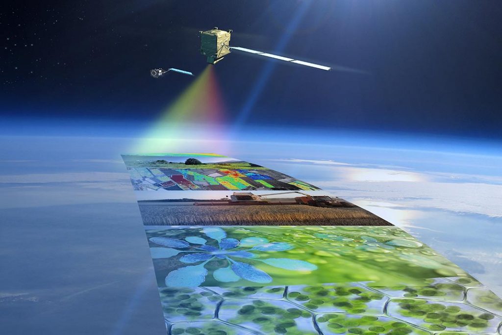
Satellite imagery is one of the most widely used remote sensing techniques for ecosystem health assessment. High-resolution images captured by satellites like Landsat, Sentinel, and MODIS provide valuable data on land cover, vegetation, and water resources. These images can be analyzed to track changes in land use, deforestation, urbanization, and other factors that impact ecosystem health.
LiDAR (Light Detection and Ranging) is a remote sensing method that uses laser light to measure distances and create detailed, three-dimensional representations of the Earth’s surface. This technique is particularly useful for assessing forest ecosystems, as it can provide accurate information on tree height, canopy density, and biomass. By analyzing LiDAR data in GIS, researchers can estimate carbon stocks and monitor changes in forest structure, which are essential indicators of ecosystem health.
Hyperspectral imaging is a remote sensing technique that captures images across a wide range of wavelengths, allowing for the detection of subtle differences in vegetation and other environmental features. This detailed spectral information can be used to identify and monitor plant species, track invasive species, and assess vegetation health – all critical factors in understanding ecosystem health.
Thermal remote sensing detects the heat emitted by objects on the Earth’s surface, providing valuable information on land surface temperature, soil moisture, and evapotranspiration. These factors play a significant role in ecosystem health, particularly in agricultural systems and wetlands. By analyzing thermal data, researchers can monitor drought conditions, water stress, and other factors that impact the overall health of ecosystems.
GIS-based modeling combines remote sensing data with other spatial data sets, such as topography, soil characteristics, and land use, to create models that simulate ecosystem processes and predict future changes. These models can be used to assess the impact of climate change, land use changes, and other environmental stressors on ecosystem health, allowing researchers and policymakers to make informed decisions about conservation efforts.
You may be interested in reading about The Benefits of Cloud Native Geospatial File Formats
Biological Indicators and Bioassessment
Biological indicators, also known as bioindicators, are living organisms or biological processes that provide valuable information about the health and quality of an ecosystem. These indicators can be plants, animals, or microorganisms that respond to environmental changes in a measurable way. By monitoring changes in biological indicators, scientists can draw conclusions about the overall health of an ecosystem and identify any negative impacts caused by pollution, habitat loss, or other environmental stressors.
Bioassessment is a systematic process that involves the evaluation of an ecosystem’s health using biological indicators. This approach typically includes the collection and analysis of samples from an ecosystem, such as water, soil, or air, to evaluate the presence and abundance of various bioindicators. Bioassessment can provide valuable insights into the ecological integrity of an ecosystem and help identify stressors affecting its health.
Environmental analytics can be applied to the study of benthic macroinvertebrates by analyzing large data sets gathered from aquatic ecosystems. By using statistical models and machine learning algorithms, researchers can identify patterns and relationships between the presence and abundance of these organisms and various environmental factors. This helps in understanding the effects of pollution, habitat degradation, and other stressors on aquatic ecosystem health and provides guidance for targeted conservation efforts.
Applying environmental analytics to fish assemblages involves analyzing fish species composition, diversity, and abundance data collected from various ecosystems. Advanced statistical techniques and predictive modeling can help identify the impacts of environmental stressors, such as water quality, habitat loss, and climate change, on fish communities. This information can be used to develop effective management strategies for maintaining healthy aquatic ecosystems and preserving fish biodiversity.
Environmental analytics can be employed to assess plant community data, such as species composition, richness, and abundance. By using spatial analysis techniques and machine learning algorithms, researchers can identify relationships between plant communities and environmental factors, such as soil quality, nutrient availability, and climate. This information can be used to predict the impacts of land use changes, invasive species, and other stressors on terrestrial ecosystems and inform targeted conservation efforts.
Environmental analytics can be applied to the study of indicator species by analyzing large-scale data sets on the presence and abundance of these organisms in various ecosystems. Advanced statistical methods and machine learning techniques can help identify trends and correlations between the health of indicator species and environmental stressors, such as pollution levels and habitat loss. This information can be used to prioritize conservation efforts and develop strategies for maintaining healthy ecosystems.
The application of environmental analytics to microbial communities involves the analysis of complex data sets, such as metagenomic and metatranscriptomic data, to understand the structure and function of microbial communities in various ecosystems. By employing advanced bioinformatics tools and machine learning algorithms, researchers can identify patterns and relationships between microbial community composition, activity, and environmental factors. This information can be used to assess the impacts of pollution, nutrient imbalances, and other stressors on ecosystem health and develop targeted conservation strategies.
Water Quality Monitoring
Environmental analytics can significantly enhance the effectiveness of water quality monitoring techniques and tools by integrating and analyzing large, complex data sets. By employing advanced statistical methods, machine learning algorithms, and visualization techniques, researchers can:
- Identify patterns and trends in water quality data to understand the impacts of pollution, land use changes, and other stressors on ecosystems.
- Develop predictive models to forecast the effects of climate change, population growth, and other factors on water quality and ecosystem health.
- Analyze the spatial distribution of water quality issues to prioritize areas for targeted conservation efforts and management strategies.
- Assess the effectiveness of implemented management actions and inform adaptive management approaches.
Remote sensing technology, such as satellite imagery and aerial photography, offers a non-invasive approach to monitoring water quality. By analyzing the reflected or emitted light from water bodies, researchers can gather information on parameters such as water temperature, turbidity, chlorophyll concentration, and the presence of harmful algal blooms. Remote sensing allows for large-scale and cost-effective water quality monitoring, contributing to the assessment of ecosystem health.
Advancements in sensor technology have led to the development of real-time water quality monitoring networks. These networks consist of multiple sensors deployed in water bodies to continuously measure various water quality parameters. Sensor networks provide real-time data, enabling rapid response to water quality issues and facilitating adaptive management strategies to protect ecosystems.
Read more: IoT for Water Quality Monitoring
Air Quality Monitoring Tools
Air quality monitoring tools are used to measure the levels of pollutants in the air, such as particulate matter, ozone, nitrogen oxides, and sulfur dioxide. These pollutants can have adverse effects on both human health and the environment, such as respiratory problems, acid rain, and smog. Air quality monitoring tools include:
- Sensors: These devices are placed at different locations and measure pollutant levels in real-time. They are often used in urban areas to monitor air quality.
- Satellite Imagery: Satellites can capture images of the Earth’s atmosphere and detect pollutants in the air. This technology is often used to monitor air quality on a large scale.
- Mobile Monitoring Units: These units are mounted on vehicles and move around to measure air quality at different locations. They can provide detailed information on pollutant levels in specific areas.
Read More: Top 5 Global Sources for Air Quality Data
Soil Quality Monitoring Tools
Soil quality monitoring tools are used to measure the physical, chemical, and biological properties of soil. These properties affect the ability of soil to support plant growth and other ecosystem functions. Soil quality monitoring tools include:
- Soil Testing Kits: These kits can be used to determine the nutrient content and pH level of soil. They are often used by farmers to determine the health of their soil.
- Soil Sensors: These devices can be placed in soil to measure soil moisture, temperature, and other parameters. They can provide real-time data on soil health and help farmers make informed decisions about irrigation and fertilization.
- Remote Sensing: Satellites can capture images of land and detect changes in soil properties over time. This technology is often used to monitor large areas of land for changes in soil health.
Biodiversity Monitoring Tools
Biodiversity monitoring tools are used to measure the diversity and abundance of species in an ecosystem. Biodiversity is essential for ecosystem function and provides numerous benefits to human well-being, such as food, medicine, and recreation. Biodiversity monitoring tools include:
- Camera Traps: These cameras can be set up in different locations and capture images of animals as they move around. They are often used to study large mammals such as tigers and elephants.
- Acoustic Sensors: These devices can record animal sounds and help identify different species based on their unique vocalizations. They are often used to monitor bird populations in forests.
- DNA Sequencing: This technology can be used to identify different species based on their DNA. It is often used to study microbial communities in soil and water bodies.
Read more: How can technology help conserve biodiversity?
Ecological Modeling and Simulation
Ecological modeling and simulation tools and techniques using environmental analytics can help researchers and decision-makers to understand complex environmental phenomena, predict future scenarios, and evaluate the impacts of human activities and policies.
Some examples of ecological modeling and simulation tools and techniques using environmental analytics are:
- Agent-based models (ABMs): These are models that represent individual entities, such as animals, plants, or humans, and their behaviors and interactions in a spatially explicit environment. ABMs can capture the emergent properties and patterns of complex adaptive systems, such as social-ecological systems, food webs, and epidemics.
- System dynamics models (SDMs): These are models that describe the feedback loops and causal relationships among the variables of a system, such as population growth, resource consumption, and environmental degradation. SDMs can help to identify the drivers and consequences of system behavior, as well as the leverage points for intervention and change.
- Cellular automata (CAs): These are models that consist of a grid of cells, each with a discrete state that changes according to a set of rules based on the states of neighboring cells. CAs can simulate the spatial dynamics and self-organization of phenomena such as forest fires, urban sprawl, and landscape evolution.
- Artificial neural networks (ANNs): These are models that mimic the structure and function of biological neural networks, composed of interconnected nodes that process information. ANNs can learn from data and perform tasks such as classification, regression, clustering, and forecasting. ANNs can be used to model nonlinear relationships and complex functions in ecological data, such as species distribution, habitat suitability, and ecosystem services.
- Bayesian Networks (BNs): Bayesian networks are probabilistic graphical models that represent the dependencies among a set of variables. They can be used to model uncertainty and incorporate expert knowledge in environmental decision-making. BNs can be applied to various ecological problems, such as risk assessment, species distribution modeling, and adaptive management.
- Fuzzy Logic: Fuzzy logic is a mathematical framework that deals with uncertainty and imprecision in data. It can be used to model complex ecological processes and systems, particularly when data is scarce or uncertain. Fuzzy logic has been applied in areas such as ecological risk assessment, habitat suitability modeling, and environmental impact assessment.
- Multi-criteria Decision Analysis (MCDA): MCDA is a decision-making approach that helps evaluate and prioritize multiple, often conflicting, criteria in complex environmental problems. It can be used to support decision-making in areas such as conservation planning, resource allocation, and environmental policy formulation. MCDA techniques can be combined with other modeling and simulation tools to provide more robust and comprehensive assessments of environmental problems.
Case Study: Using Environmental Analytics to conduct Wetland Restoration Assessment
One example of how environmental analytics can be used for a wetland restoration assessment is the case study of wetland degradation and restoration in the Lake Victoria Basin in Africa . This study assessed wetland degradation and restoration in four wetland sites using a combination of remote sensing, GIS and field data. The study determined the spatial-temporal extent and drivers of wetland use/cover changes and wetland degradation using land use/cover maps derived from Landsat images. The study also established the best steps, lessons and principles of conducting wetland restoration based on stakeholder interviews, literature review and field observations.
Another example of how environmental analytics can be used for a wetland restoration assessment is the systematic review of indicators of coastal wetlands restoration success . This review analyzed 113 studies on coastal wetlands restoration (mangroves, saltmarshes and seagrasses) to determine trends in monitoring indicators. The review classified indicators following the Society for Ecological Restoration template, adapting it to coastal wetlands. The review found that indicators on structural diversity (e.g., tree height, fish size) were the mostly commonly used, while indicators on ecosystem function (e.g., carbon sequestration, nutrient cycling) were less investigated. The review proposed a recovery wheel framework adapted to coastal wetlands to help select the most appropriate indicators for each restoration project.
These examples show how environmental analytics can provide valuable information for wetland restoration assessment. Environmental analytics can help identify the causes and consequences of wetland degradation, design effective and efficient restoration strategies, monitor and evaluate restoration progress and outcomes, and communicate and disseminate restoration results and impacts.
Case Study: Forest Management and Conservation Planning using Environmental Analytics
A project that applies environmental analytics for forest ecosystem management is the Forest Ecosystem Management Decision Support (FEMDS) system developed by the USDA Forest Service. FEMDS is a web-based system that integrates various models and data sources to help forest managers to plan, analyze, and implement ecosystem management at different spatial scales. FEMDS allows users to define management objectives, generate and compare alternative scenarios, visualize spatial data and results, and generate reports and maps.
One example of a project that uses environmental analytics for forest management planning in Canada is the Canadian Forest Service’s Forest Change Data Catalogue. Forest Change is a web-based platform that provides access to data products and tools related to climate change impacts on forests. Forest Change helps users to explore historical trends and future projections of climate variables, bioclimatic zones, fire weather indices, insect disturbances, tree species distribution models, carbon budget models, adaptive capacity indicators, vulnerability assessments, adaptation strategies, best practices guides, case studies, publications
Conclusion and Future Directions
Environmental analytics provides valuable tools and techniques for assessing ecosystem health. The concept of ecosystem health is complex and multifaceted, requiring a holistic and integrative approach. Environmental analytics offers a way to collect, analyze, and visualize large and diverse datasets from various sources, enabling a comprehensive understanding of ecosystem health.
While environmental analytics has already made significant contributions to the assessment of ecosystem health, there are several areas where further research and development are needed. These future directions include:
- Data integration and interoperability: As the field of environmental analytics continues to grow, there is a need for better integration and interoperability of data from different sources. This includes developing standard data formats, protocols, and ontologies that can facilitate the exchange and integration of diverse datasets. Additionally, efforts should be made to develop tools and techniques for integrating data from different disciplines, such as ecology, hydrology, climatology, and social sciences.
- Advanced data analytics techniques: As environmental datasets continue to grow in size and complexity, there is a need for more advanced data analytics techniques that can handle and analyze these datasets. This includes developing advanced statistical methods, machine learning algorithms, and artificial intelligence techniques that can extract patterns, relationships, and insights from large and diverse datasets. Additionally, there is a need for techniques that can handle spatial and temporal data, as many environmental datasets are characterized by spatial and temporal variability.
- Uncertainty and risk assessment: Ecosystem health assessment involves dealing with various sources of uncertainty, including measurement errors, model uncertainties, and inherent variability of natural systems. Future research should focus on developing techniques for quantifying and communicating uncertainties in ecosystem health assessment. This includes developing probabilistic models, Bayesian approaches, and uncertainty visualization techniques. Additionally, efforts should be made to integrate risk assessment frameworks into ecosystem health assessment, allowing decision-makers to make informed decisions under uncertainty.
- Citizen science and participatory approaches: Citizen science and participatory approaches can play a significant role in ecosystem health assessment. These approaches involve engaging the public in the collection, analysis, and interpretation of environmental data. Future research should focus on developing tools and techniques that can facilitate citizen science and participatory approaches in ecosystem health assessment. This includes developing user-friendly data collection tools, data management platforms, and analytical tools that can be easily used by non-experts. Additionally, efforts should be made to address issues related to data quality and reliability in citizen science.
- Decision support systems: Environmental analytics can play a crucial role in supporting decision-making processes for ecosystem health management and conservation. Future research should focus on developing decision support systems that can integrate ecological models, socio-economic data, and stakeholder preferences to facilitate informed decision-making. These decision support systems should be user-friendly, interactive, and capable of providing real-time information to decision-makers.
- Capacity building and education: As environmental analytics becomes more prevalent in ecosystem health assessment, there is a need for capacity building and education programs. These programs should aim to train researchers, practitioners, policymakers, and the public in the use of environmental analytics tools and techniques. Additionally, efforts should be made to develop interdisciplinary curricula and training materials that can facilitate collaboration and knowledge exchange between different disciplines.
Next Steps
Round Table Environmental Informatics (RTEI) is a consulting firm that helps our clients to leverage digital technologies for environmental analytics. We offer free consultations to discuss how we at RTEI can help you.